Sunday, December 28, 2014

Tom Thwaites

Trails don't just happen; they need people to nurture them into existence. Tom Thwaites, Father of the Mid State Trail, died on Christmas. The Mid State Trail is the wildest trail in Pennsylvania and is an integral part of the Great Eastern Trail.

I never met Tom Thwaites in real life, but hiking the Mid State Trail felt a little bit like meeting him.  Trail creators, builders, and maintainers leave their fingerprints on their trails; they weave their hearts into the trails they love.  No, I never met him, but nevertheless, maybe I knew him.

Hike his Mid State Trail.  Better yet, volunteer on the trail to help maintain his legacy. Best still, volunteer and join the organization for just $12/year.  And if you live nowhere near Pennsylvania, find your local trail and spend a day improving it. Please give back to the trails you love so that others may discover them too.

Wednesday, December 3, 2014

Shenandoah Mountain news

New Plan Offers Protection for Shenandoah Mountain is an article about a great example of compromise and synergy between user groups who enjoy their trails in different ways and want to protect the land that they love. Check it out.
 Some portions of the GET are open to bikes and the Shenandoah Mountain Trail is one of them.  (There are other portions of the GET where I’d love to eat popcorn and watch people try to bike it.)


Bikers have done a lot of maintenance on trail, and those we met ranged from courteous to ultra-friendly, offering us water (we didn't need it, but it was a very sweet gesture).  I was not offended to share trail with them – I felt like they were the ones sharing it with me.  I was grateful to be there.

The Shenandoah Mountain Trail would make one of the best section-hikes along the entire GET and I highly recommend it, whether you have a few days to thoroughly enjoy it or whether you have a day to hit some of the highlights.  This trail has far-reaching views, a sweet tower, a hidden spring, flowing streams, easy grades, and is well-maintained.  It also hosts the high point of the GET: a small field with seasonal views called Bother Knob.


This is a spectacular area.  Sometime in the next decade I'll be deciding between re-hiking the GET or revisiting another trail, and this section is huge plus for the GET.  No one who has visited Shenandoah Mountain would question why it needs protection.   I hope this plan will become reality. 
You can check out the Friends of Shenandoah Mountain page for more information.

For right now, a guide to the area can be found online.  Soon it will be in book form!  Woohoo!

Monday, December 1, 2014

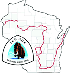
Great Eastern Trail vs. Ice Age Trail

The Differences             
Great Eastern Trail


  • 1,600-ish miles, Alabama to New York

  • Generally painted blazes of every color: red, orange, yellow, gold, green, blue, purple, white


  • High point 4,300 ft

  • Months of prep recommended to gather together the needed resources


  • About 20 shelters

  • A few outfitters on or near the trail


  • Locals generally unaware of the GET

  • 3-4 months needed to thruhike
Ice Age Trail


  • 1,100-ish miles, Wisconsin to . . . Wisconsin!

  • Yellow blazes that may be painted or plastic markers on trees, on stakes, may be different shapes

  • High point 1,920 ft

  • Thorough map and guidebook available for purchase, free updates and hiker notes from volunteers

  • A few shelters

  • I don't know of an outfitter along the trail; REI accessible by a long shuttle


  • Locals more generally familiar with the IAT

  • 2-3 months needed to thruhike


The Similarities

  • The Ice Age Trail and the GET have much more in common than I would have guessed.  Most importantly, with both trails, were the people.  I feel like each trail I hike brings wonderful lifelong friends into my life, and the IAT was no exception.  
  • These trails are also both lonely.  While Devils Lake (IAT) may always be comparatively crowded and the Thousand Steps (GET) is a popular dayhike, neither of these trails boast many long-distance hikers.  I met 4 on the Ice Age Trail.
  • Easy resupply due to frequent town visits - just one section on each trail that is dicey for resupply
  • Challenging camping situations at times due to private land or public land where camping is not allowed
  • Maps are a necessity - neither the GET nor the IAT is fully blazed (this mostly applies to connecting roadwalks but there are wooded sections that are unblazed or underblazed
  • Both trails have an element of choose-your-own-adventure, as the connecting roadwalks are often unofficial and you can link the trail together by foot as you like.
  • Both trails have a bifurcation!  East or west, which will you choose?
  • They have similar ideal seasons for hiking: spring or autumn are your best bets to avoid ticks, heat, and mosquitoes.
  • Both are routed through a large city (Chattanooga for the GET, Janesville & Madison for the IAT)

Sunday, November 30, 2014

Ice Age Trail video

Hi all.  Just a quick update to say that I've been out of the woods for a month now after finishing the Ice Age Trail.  I have to say, the Ice Age Trail got a little rough at the 800-mile mark when I realized that I had walked the equivalent of Alabama to Mullens, West Virginia . . .  but I was still in the same state.  But overall it was a perfect adventure.  If anyone's interested I made a video about the experience:

-jo

Sunday, August 10, 2014

Jo's next adventure

Hi GET friends!  I'll be hiking the Ice Age Trail this fall.

You can follow along at my blog: Someday on the Ice Age Trail.

Have a great autumn and happy hiking!

Saturday, August 2, 2014

Cheaha State Park Visit


Daniel, Ben, Sarah, and Jon
The economic impact of a trail is not just in the hikers themselves; it is in the promotion of these locations as destinations.  Today my sister's family visited Cheaha State Park.  The Alabama Pinhoti Trail goes through the park and they're visiting because they heard about it from the GET hike last year.  If the GET didn't exist, I doubt they would have ended up here today. This is pretty cool. I'd love to be there too!


Ben surveys the beautiful beginnings of the Appalachians


Thursday, July 17, 2014

GET website

The Great Eastern Trail's official website has been redesigned, and it is fantastic!  Check it out: http://www.greateasterntrail.net/

Monday, July 14, 2014

Pennsylvania Rock Garden


We're on to you, trailbuilders!  We know Pennsylvania's secret.

Sunday, July 13, 2014

East Route vs. West Route

Between Hancock, MD and Detweiler Junction near State College, PA there are two official routes that the Great Eastern Trail aligns with.  Either route is legitimate for a thru-hike.

Assuming a northbound hike, the decision happens in Hancock, where you turn either right or left onto the C&O Towpath.  Turning right takes the hiker to the west route.  Turning left joins the east route.  (Does this seem backwards?  Yeah it does, but it isn't.)
East and West Routes - C&O Towpath
The east route utilizes the C&O for about 8 miles. 
This view is super awesome for, like, 2 hours.
The west route follows the C&O for 30+ miles.

The towpath is almost completely flat, and while it's possible to knock out 20+ miles per day on the trail with decent camping spots and potable (although highly iodined) water, it presents numerous issues such as bike traffic, monotonous bugs, monotonous pounding of the feet, and, well, general monotony.


 East Route - Tuscarora Trail
On the east route, the GET continues on the Tuscarora Trail through Maryland before entering Pennsylvania.  The GET briefly continues on the Tuscarora to Cowan's Gap State Park where the Tuscarora and GET separate.  Highlights of this short section include:

  • Crossing the Maryland/Pennsylvania border at a nice wooded location
  • Two shelters, one with a pond
  • Hang glider ramp (don't get any ideas)
  • A biker bar atop Tuscarora Mountain
  • Potential resupply in McConnellsburg, off trail
  • Cowan's Gap State Park

East Route - Standing Stone Trail
The east route next veers onto the Standing Stone Trail.  The GET follows this trail for its entire length, meaning an eastern hike includes an automatic end-to-end of the Standing Stone Trail.  The SST leads to Greenwood Furnace State Park.  Highlights of the Standing Stone Trail include:

  • A giant stone monolith
  • Potential limited resupply in Three Springs
  • Potential limited resupply near Mapleton
  • The Thousand Steps
  • Hall of the Mountain King
  • Throne Room
  • Butler Knob Shelter
  • Rocky Ridge Natural Area

East Route - Greenwood Spur
From the northern terminus of the Standing Stone Trail, the GET follows the Greenwood Spur Trail to meet up with the Mid State Trail.  Highlights of this short trail are:

  • Greenwood Furnace State Park with some amenities
  • Alan Seeger Natural Area, a ridiculously lush and gorgeous section of trail

West Route - Green Ridge State Forest
Green Ridge State Forest is a beautiful and challenging section of the Great Eastern Trail.  Northbound hikers will get to make up for the long flat walk to get there.  Highlights include:

  • Access to official campsites and shelters - some with porta-potties!
  • Breathtaking views
  • A more thorough representation of Maryland 
  • Potential resupply in Flintstone, Maryland

West Route - Mid State Trail
The western route hiker will complete the entire Mid State Trail, starting at the Mason-Dixon Line/PA-MD border, continuing to Detweiler Junction where both routes come together, and heading to the NY line.  Highlights of the MST from Maryland to Detweiler Junction include:


  • A superb and amusing guidebook
  • Frequent register boxes or mailboxes
  • A GET diamond at the border
  • Martin Hill area
  • Sweet Root Natural Area
  • Fantastic resupply in Everett
  • Tenley Park's free camping
  • New Frontier Restaurant just off trail at Loysburg
  • Maple Run Valley, a fairy wonderland
  • More fantastic resupply in Williamsburg
  • Jo Hays Vista among others
  • A gorgeous walk through Rothrock State Forest

Okay, okay, whatever -- which one is best?

Both of 'em.  I cannot recommend one route over the other; it depends on your strengths and weaknesses and what you want to get out of your hike and what kinds of challenges you appreciate.

In terms of overall difficulty, the western route is moderately more challenging due to being longer and also the rockiness of MST Sections 7, 3, and 2 in particular.  The western route has significant water issues and also lacks legal camping locations along some sections of the MST, leading to long days.

BUT...The western route is easier in that there is only one guide/map set needed (other than printing the free Green Ridge State Forest maps) and it is fantastic. The western route is also much easier for quality resupply.  Also, there are many stretches of the southern route that I would rate as very easy, terrain-wise.


The eastern route's difficulties are that it requires no fewer than three guides/map sets of varying updatedness.  There are frequent rocky sections (particularly the Stone Mountain section of the SST).  It is also very challenging to resupply on this stretch and a maildrop would not be a bad idea.

BUT... The eastern route holds perhaps more iconic locations.  Overall, its water situation is sufficient - while there are dry (and rocky) sections, they are not nearly as long or arduous as the western route's.  The east route also spends less time on the C&O, which for me is a plus but might not be for you.

Choose your own adventure! 
-jo

Saturday, July 12, 2014

One fun summer

We had a great hike.  The Mid State Trail is well-cared for and a wonderful, wild adventure.  It's also probably the toughest trail I have ever hiked, mile-for-mile.

When we started the trail, it was hot.  Incredibly hot.  And, um, rather rocky.  I mean, we knew it would be rocky.  But it was ROCKY.*

With the combo of the heat and the rocks, I found that maintaining a daily mileage to fit our very tight schedule was, in short, no fun.  Not even with early starts and cool morning temperatures.

*No joke.
We made a decision in the first week to abandon the idea of the Allegheny Trail.  This was a bummer, because we are both super excited about West Virginia's longest trail.  But ultimately, finishing the western route of the Great Eastern Trail and having fun while doing it -- that was much more important.  This wasn't a big trip; it was a summer adventure, and summer adventures ought to be fun.  Because we changed our plans, it was a total blast.

So more of this was possible.
Since we decided to chill out a little bit, we were able to visit with trailbuilders and Bart was able to do his first out-of-WV trail maintenance.  We were able to wait out some hot weather later on in the trip and meet some pretty great people in the process.  The trip turned from deathmarch to summer vacation.  That was good for morale and my busted up knee that now has a super awesome scar.


Hiking in this feels, well, stupid.

Being able to go slow on hot summer days was incredibly rewarding.  Important too, given that we traversed some very dry sections.  I'd never had to carry 4+ liters of water  before.  It was a good experience.  It was Type II Fun.

We can't thank our Pennsylvania and Maryland friends enough for their help and company this summer.  It was a great adventure.

And as for the Allegheny Trail -- well, my trail name is "Someday."

At the southern bifurcation location in Hancock, MD

We're now looking forward to ten days in southern West Virginia together and we're hoping to get some Great Eastern Trail work done here in Mullens.  

Friday, July 4, 2014

Goodbye Hancock!

Good by for now! Leaving Hancock MD and one of our favorite places to rest on the trail C&O Bicycle Shop! Thanks for another laid back stay in the chicken coup Dennis!

Thursday, July 3, 2014

Gear and beer

Gear and Beer!
A smart hiker has multiple uses for the the gear that travels with them. Take my pack cover for instance:
1) protects my pack from rain or heavy brush that might damage it
2) a dry seat to eat when ground is wet
3) I can place dirty and wet clothes in it to keep cleaner dryer clothes separate
4) they come in bright orange to match the hunters attire during open season
5) placed around inflatable sleeping pad to help resist puncturing
6) the perfect impromptu beer cooler!
-HBB

Tuesday, July 1, 2014

Trail finds

I love mayonnaise and Jo likes port-a-pots.

Green Ridge

Me and Jo take in some nice views offered by the Green Ridge SF.

Monday, June 30, 2014

CTC

Shout out to the CTC! I have been receptionless for days and just found out that you all exist again. We are So happy! Long live the Cumberland Trail Conference! -j and hbb

PA rockpile in MD

The tradition continues on the south end. You're welcome PA!!!

Sunday, June 29, 2014

Volunteers hard at work

It was a nice surprise to see Deb, Ray and Jake twice today out on the trail. We were enjoying the fruits of their labor and conversation.
Here is Ray clearing the way and Jake guarding his back. This is the trail version of walking the red carpet!

Friday, June 27, 2014

CTC meeting

The Cumberland Trail sticker has gone everywhere we have since hiking it last year. Best of luck, Cumberland Trail Conference, on the important meeting tomorrow. CTC deserves to be reinstated and continue its fine work. Someone please let us know how the meeting goes. I will check for cell reception compulsively. Love to TN. Thank you for not giving up. -j (and hbb)

New sidehill

Jo tests out the side hill work Deb and crew worked on last Saturday. She was worried it would all get washed away after some big rain but GOOD JOB Trail Volunteers! It looks great and I really can't believe you finished it! Me and John Stein slid down this thing last Friday and today me and Jo could easily walk up it. Without Trail Volunteers hiking would be almost nonexistent and defiantly not as pleasurable. -HBB

Water run

My happy face when I find water!

The water source looks questionable but I Steri Pen everything. One mile round trip - up hill both ways but we are both flush with water for the upcoming dry section.

Ditch find

Well it happened again-look what I found in the ditch. It was 5 1/4 lbs of extra fluid weight but I get to get rid of it all (but the can weight) tonight!
Why am I so lucky?

Thursday, June 26, 2014

Tenley Park

A life long philosophy instilled in me through my wonderful parents is : "Leave it better than you found it!"
We have been so blessed to enjoy Tenley Park the last two nights and have some special people check in on us like: Don, Officer Fletcher, Jack, Sue, Nevaeh, Deb and Jake!
I policed the shelter of all cigarette butts and still find it hard to believe people don't consider this trash? It's a small token of our appreciation but Helen Kellar said it best:
"I am only one but still I am one. I can't do everything but I can do something!" HBB

Wow.

I deeply wish I lived in Everett so I could hire this guy. -j

Wednesday, June 25, 2014

Motel 30

We had a fabulous stay at Motel 30! Sue is incredibly hiker-friendly and gave us a ride back to Everett this morning. This is a great option for Mid State Trail/GET hikers and we can't recommend it highly enough! She is willing to pick up hikers in town and bring them out for a stay. Thanks again!

Tuesday, June 24, 2014

Everett

Storm is rolling in and we are under a roof tonight just outside of Everett, PA. Air conditioning, nice cold showers (by choice - it was a scorcher today) and food from the nearby gas station. Life is really pretty great right now.

Volunteers make it happen.

John Stein and Deb Dunkle getting ready for trail work on the MST.
Below is the new bridge Deb worked on for 10 years that safely crosses Yellow Creek.
I'm sure Deb would like to know that right after me and Jo crossed a bunch of teenagers came up the trail from cooling themselves in the river using this fabulous bridge. Good work Deb!